When visiting a new place most people lace up their shoes or boots and start walking. Sightseeing is something usually done on foot, but here’s the real truth about making the most of your trip: walking takes time and energy!
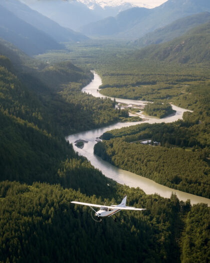
If you’re short on time or have elderly or young travellers in your group, sightseeing by plane is a perfect way to see all the same (if not more) incredible views as hikers and backpackers.

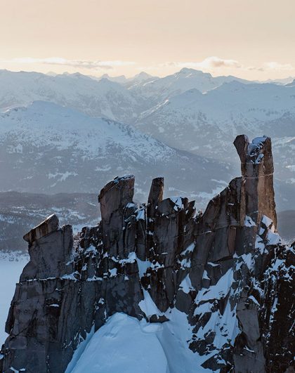
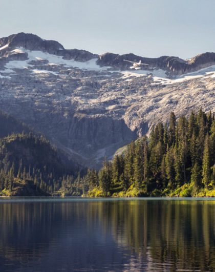
Black Tusk is such a visible and identifiable peak from so many places along the Sea To Sky Highway. It’s become a must-do bucket list item for locals and visiting hikers in Southwestern British Columbia. The view from the peak an almost 360º view of Garibaldi Provincial Park with Helm Lake and the Cinder Flats at the foothills and the Fitzsimmons Range in the distance.
To reach the 360º views at the top of the Black Tusk hikers must ascend the last stretch to the crown via a narrow chimney involving a climb of about 100m. Only properly equipped and experienced climbers should attempt it.
Black Tusk by air stats
550 sq km covered
50 min round trip
8500 ft (2591 m) elevation gain
Beginner
Flight: Whistler Backcountry Air Safari
Black Tusk hiking stats
29km round trip
11 hours
1740m elevation gain
Intermediate – Advanced
Info from: www.vancouvertrails.com/trails/black-tusk/

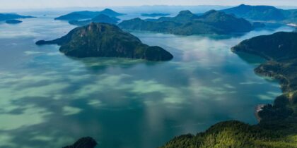
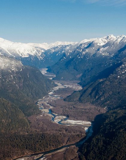
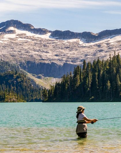
Just northwest of Squamish, in the Tantalus Range, is the Lake Lovely Water Recreation Area – it is one of the most beautiful and rewarding hikes in the region. Scenic Lake Lovely Water is located at 3800 feet above sea level in a remote wilderness area popular for advanced hiking, climbing, mountaineering, and backcountry ski touring.
The trail to Lake Lovely Water is located on the west side of the Squamish River. There is no road access to the Lake Lovely Water trailhead so you will need to cross the river by boat or canoe.
Lake Lovely Water by air stats
200 sq km covered
35 min round trip
6500 ft (1981 m) elevation gain
Beginner
Flight: Squamish Explorer
Lake Lovely Water hiking stats
12.8 km round trip
21 hours / overnight
3840 ft (1170 m) elevation gain
Advanced

Elfin Lakes is probably Garibaldi Provincial Park’s 3rd most popular hike after the Black Tusk and Garibaldi Lake trips. Look down and there are beautiful summer meadows full of wildflowers, look up and you’ll see ancient glaciers spilling off the east side of the volcanic Mount Garibaldi.
Hikers can either stay at the Elfin Lakes Shelter (no facilities provided) for one night or camp at the Elfin Lakes campground if you wish to stay multiple days and explore areas such as The Gargoyles, Columnar Peak, and The Saddle.
Elfin Lakes by air stats
550 sq km covered
50 min round trip
8500 ft (2591 m) elevation gain
Beginner
Flight: Whistler Backcountry Air Safari
Elfin Lakes hiking trip stats
22 km round trip
7.5 hours
1970 ft (600 m) elevation gain
High point 1600m (5250 ft)
Intermediate
https://www.facebook.com/seatoskyair/videos/10154767725129453/?t=0
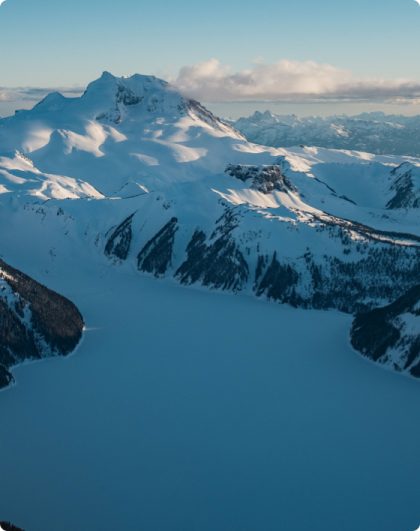
We say this a lot but, Garibaldi Lake is the jewel in the crown that is Garibaldi Provincial Park. With its turquoise waters, wild volcanic past, Battleship Islands, and wildflower meadows Garibaldi Lake is breathtaking no matter how many times you experience it. There are usually crowds on weekends unless you hike in early fall.
Garibaldi Lake by air stats
550 sq km covered
50 min round trip
8500 ft (2591 m) elevation gain
Beginner
Flight: Whistler Backcountry Air Safari
Garibaldi Lake hiking stats
19.5 km (11.5 mi) round trip
6.5 hours
3020 ft (920 m) elevation gain
High point 1500 m (4910 ft)
Intermediate

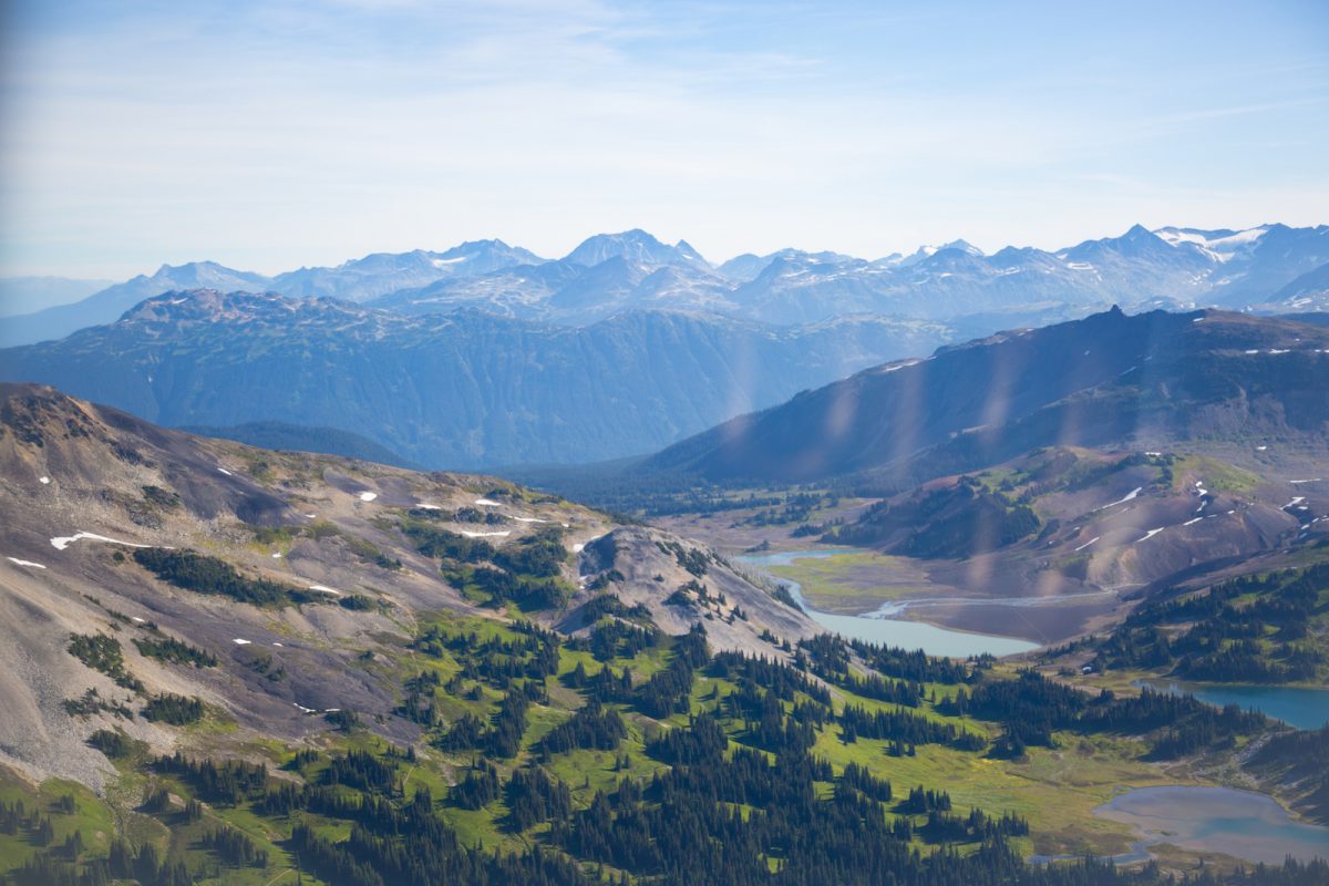
Panorama Ridge, aptly named because of its stunning view over the blue-green waters of Garibaldi Lake, the Battleship Islands, Mount Garibaldi, Table Mountain, and volcanic landmarks such as Castle Towers, Mount Price, Clinker Peak, and Black Tusk.
Much like the Black Tusk hike, this trip can be done from the Rubble Creek parking lot but is much nicer from the Taylor Meadows direction. The high elevation means that in summer months there can still be knee-high snow.
Panorama Ridge by air stats
550 sq km covered
50 min round trip
8500 ft (2591 m) elevation gain
Beginner
Flight: Whistler Backcountry Air Safari
Panorama Ridge hiking stats
30km round trip
11 hours round trip
1520m elevation gain
High point 2105 m (6900 ft)
Intermediate – Advanced (depending on snow)
Info from: www.vancouvertrails.com/trails/panorama-ridge/

Starting from the Sea to Sky Gondola parking lot, the Sea to Summit Trail rises through the lower sections of the Stawamus Chief trail and then diverts onto the newly built Sea to Summit Trail. Views of the Howe Sound, Sky Pilot and the surrounding peaks are abounding as you ascend through the once, untouched forest next to the Sea To Sky Gondola.
Sea To Sky Gondola & Sea To Sky Summit by air stats
550 sq km covered
50 min round trip
8500 ft (2591 m) elevation gain
Beginner
Flight: Whistler Backcountry Air Safari
Sea To Sky Gondola trail hiking stats
15 km (9.3 mi) round trip
5 – 7 hours round trip
1477 ft (918 m) elevation gain
Intermediate – Advanced. Requires fixed rope lines to assist you at certain sections and the downhill hiking is very steep.
https://www.facebook.com/seatoskyair/videos/10156045590404453/?t=1
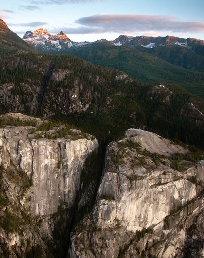
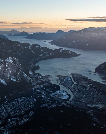
The Stawamus Chief is the second largest granite outcrop in the world and its towering rock face cannot be missed as you drive through Squamish on Highway 99 (aka Sea to Sky Highway). “The Chief” as it’s known locally is loved by hikers and rock climbers from all over. There are three peaks available to hikers: South, Centre, and North. From here guests get a sweeping view of the Squamish Valley, Mount Garibaldi, the Howe Sound, and the Tantalus Range.
The Stawamus Chief trailhead is at the gate to the Stawamus Chief Viewpoint campground.
Stawamus Chief by air stats
50 sq km covered
25 min round trip
3500 ft (2591 m) elevation gain
Beginner
Flight: Sea To Skypilot
Stawamus Chief trail hiking stats
15 km (9.3 mi) round trip
6 – 8 hours round trip
1477 ft (918 m) elevation gain
Intermediate – Advanced. Requires fixed rope lines to assist you at certain sections.
Part of a large group travelling together? Book online or call and speak to our pilots directly on 604 898 1975.