Sea-to-Sky landscapes are defined by contrast, and this guide breaks down what you’ll see across the corridor—from coastal inlets and rainforest to alpine ridges, rivers, granite cliffs, and glaciers.
In such a short distance, the scenery changes dramatically. That’s why the Sea-to-Sky feels so alive and unforgettable. However, when you only experience it from the road, it can be hard to understand how these landscapes connect.
A scenic flight changes that. From above, the Sea-to-Sky becomes a complete picture. You see the transitions clearly, and the scale finally makes sense.
A lot of places have mountains. Others have ocean. Some have dense forest. The Sea-to-Sky has all of it, and the shifts happen quickly.
As you travel north, the landscape changes from coastal coastline to rainforest valleys. Then, within minutes, the terrain rises into alpine ridges and snow-covered peaks. Because of that, the region often feels like multiple worlds in one.
From a scenic flight, those transitions become even more striking. Instead of a single viewpoint, you get a wide, connected view of the corridor.

Squamish Coast
At the southern end of the Sea-to-Sky, the landscape is shaped by the Pacific Ocean. Coastal inlets, shoreline curves, and deep water sit right alongside steep mountain walls.
From the road, you might notice how close the ocean is to the peaks. From above, you see the full layout. In particular, you can see how the coastline cuts into the land and how quickly the mountains rise.
This is one of the defining features of the Sea-to-Sky. Water and rock sit side by side, creating dramatic contrast.
Phantom Lake
The Sea-to-Sky is home to coastal temperate rainforest. This ecosystem is dense, vibrant, and full of texture. It thrives because of the region’s moisture and mild coastal climate.
On the ground, the forest feels immersive. From the air, it becomes a living pattern. You can see how the canopy spreads across valleys and climbs up slopes.
As elevation increases, the rainforest begins to thin. Over time, it gives way to exposed rock and alpine terrain. That shift is one of the most fascinating transitions in the corridor.

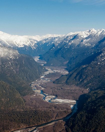
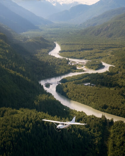
Squamish River
Rivers shape the Sea-to-Sky in powerful ways. They carry meltwater from higher terrain, carve through valleys, and support ecosystems along the corridor.
From above, rivers become easier to follow. Instead of a single crossing or viewpoint, you can trace the full route. You can also see braided channels, wide riverbeds, and how waterways connect to wetlands and coastline.
In other words, the aerial view turns a “river scene” into a complete watershed story.
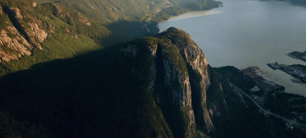
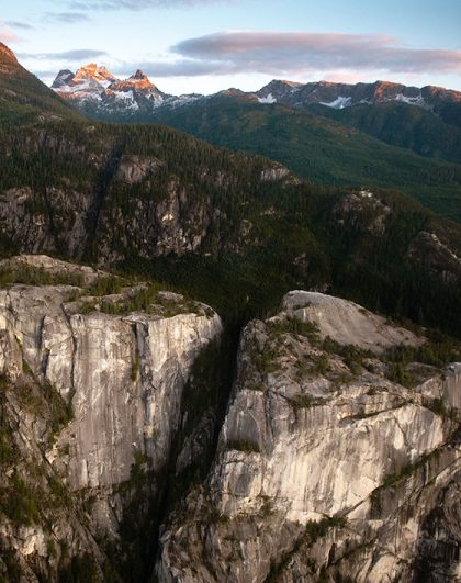
The Squamish Chief
Squamish is famous for granite, and that rugged rock is a major part of the region’s identity. Cliffs and steep faces rise sharply from the valley, creating a strong visual contrast against the forest.
From the air, the granite becomes even more dramatic. You can see where rock dominates the landscape. You also notice how the terrain shifts from soft, green canopy to sharp grey edges.
This is where the Sea-to-Sky feels bold. It’s steep, powerful, and unmistakably West Coast.

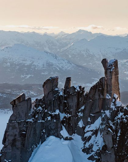
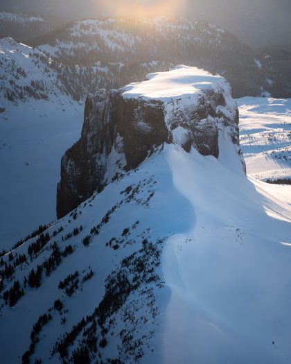
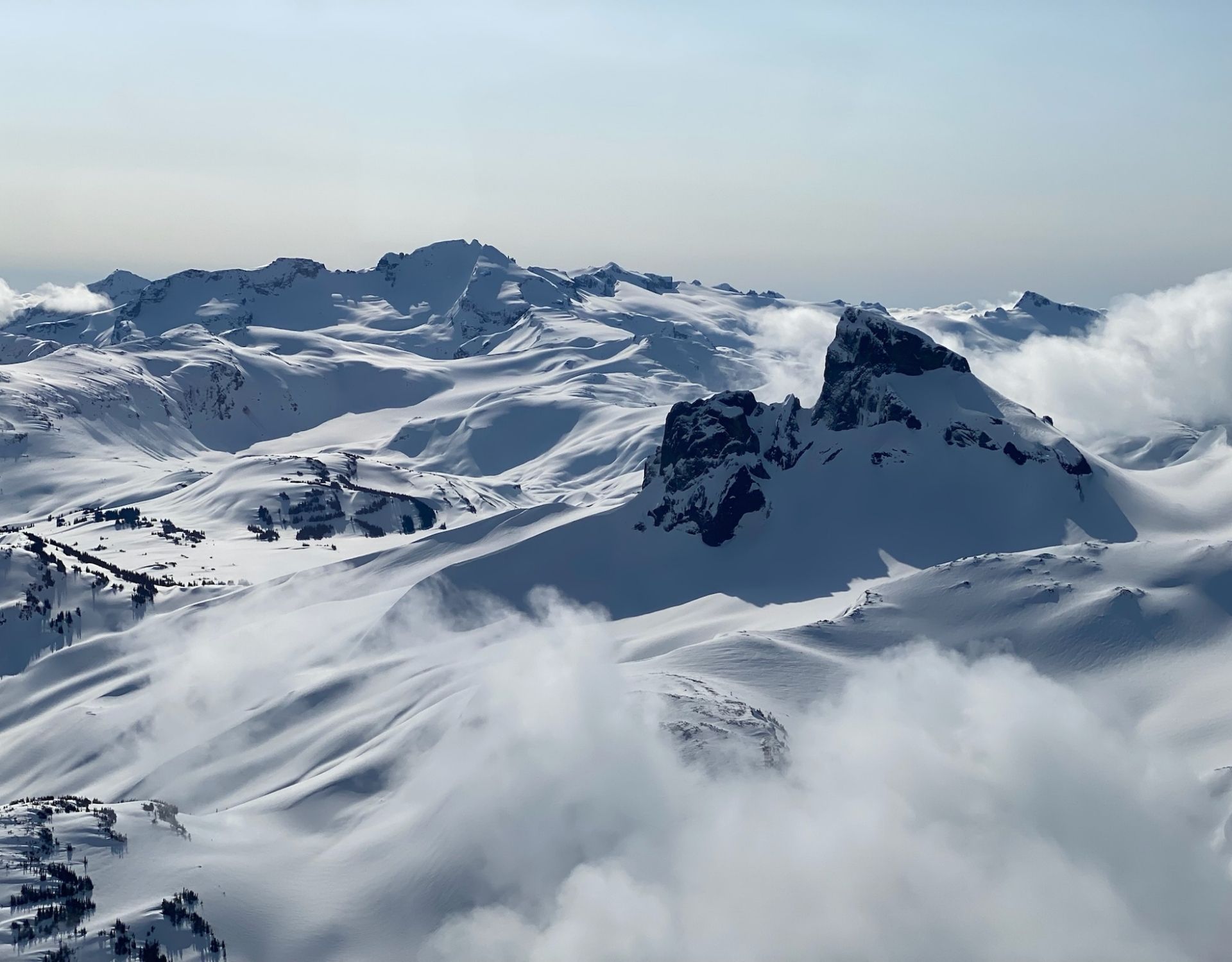
Garibaldi
Above the tree line, the Sea-to-Sky changes again. Alpine terrain is open and exposed, with ridgelines, plateaus, and snowfields that stretch farther than many people expect.
From a scenic flight, you can see how connected the alpine really is. Ridges link together. Valleys open up. The landscape becomes wide and expansive.
Although the alpine can feel remote on the ground, it’s incredibly visible from above. As a result, it becomes one of the most memorable parts of any scenic flight.
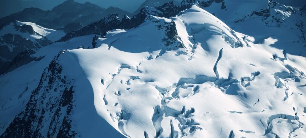
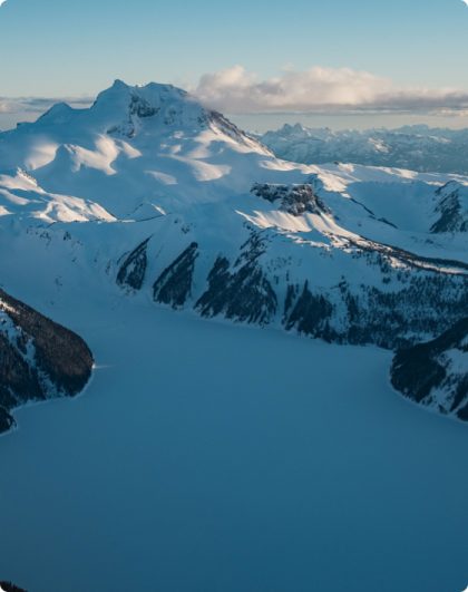
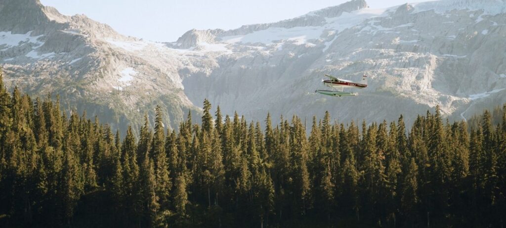
Squamish Glacier
Higher in the mountains, you’ll find glaciers and icefields. These features help shape the region’s valleys and feed many of the waterways below.
From the air, glaciers stand out clearly. Bright ice contrasts against dark rock and snow. In addition, you can often see texture in the ice, including crevasses and layered formations.
Even for locals, glaciers can feel surprising. They’re closer than many people realize, and they add another layer to the Sea-to-Sky’s story.
Seeing the Sea-to-Sky from the air isn’t just about “more views.” It’s about understanding the landscape as one connected place.
For example, you’ll see how:
That perspective often shifts how people feel about the region. It adds context, appreciation, and a deeper sense of connection.
If you want to experience Sea-to-Sky landscapes in a more complete way, a scenic flight offers something the road can’t. It gives you the full picture. It also gives you space to slow down and take it all in.
At Sea to Sky Air, our mission is to make the transformative power of raw wilderness and the Squamish backcountry accessible to all. We want you to leave feeling connected, renewed, hopeful, inspired, and amazed.
Explore our tours and book your scenic flight today. Whether you’re visiting the Sea-to-Sky for the first time or rediscovering it as a local, we’ll help you experience it in a way that feels truly unforgettable.