Squamish is an inspiring place to live and visit. Its distinct Pacific coast beauty calls to millions of travellers each year. The geological features and dramatic landscapes are a large part of what makes Squamish a recreational paradise. A super, natural playground for locals and visitors to play, connect, and relax. In the field of geology, Squamish is an incredibly complex landscape that has been built and moulded by larger-than-life forces over millennia. And much of that shaping is still occurring today before our eyes. With so much to see and discover it can sometimes be hard for you to easily describe to friends and family exactly what they’ve seen.
In this post, we’re breaking down the good-to-know geology terms of our favourite places specific to the Squamish area. You’ll be a pro in no time. Or, at the very least, you’ll now have some great knowledge bombs for your Instagram captions!
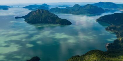
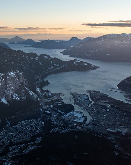
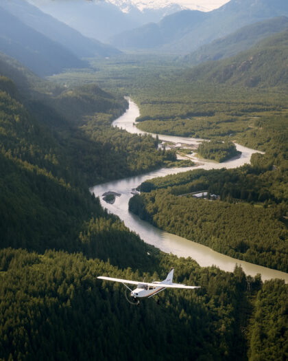
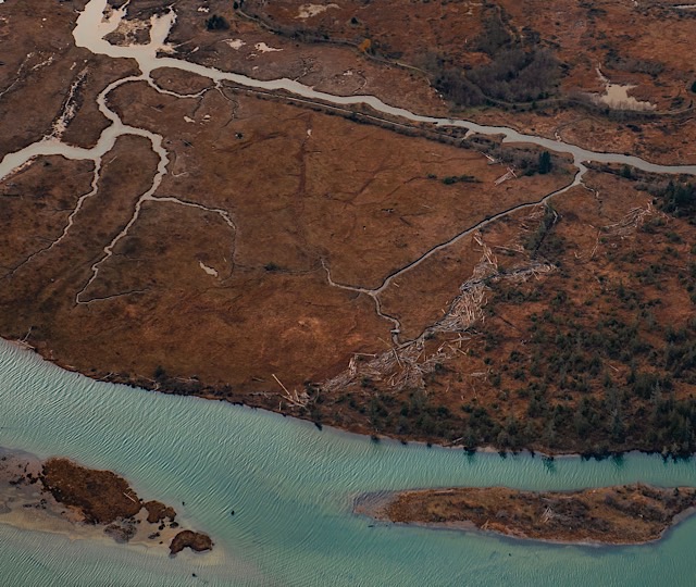
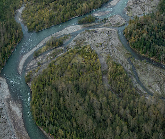
An estuary is defined as a “water passage where the tide meets a river current”. It is where a freshwater river mouth meets and mixes with the oceans marine water. Estuaries are known as some of the most abundant ecosystems on earth. The Squamish Estuary is a wonderful example of an abundant and vibrant ecosystem. It is an essential habitat for many life forms in the area, especially for salmon, bears, grasses, insects and hundreds of species of birds – especially eagles who, in winter months, can be seen fishing from the banks The Squamish estuary can be seen from any of the flight tours we offer.
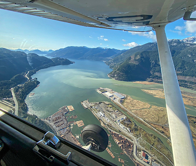
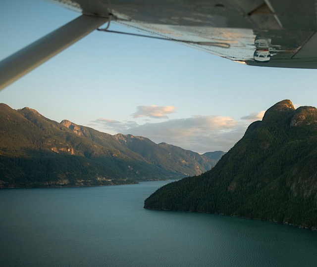
A fjord can be described as a “narrow inlet of the sea between cliffs or steep slopes”. Fjords are mostly found in the northern latitudes of Scandinavian regions, another reason the Howe Sound in Squamish is so very special. 935 feet deep and 44km long, the Howe Sound is North America’s southernmost fjord. Its unique geography is the perfect illustration of where the name Sea To Sky Corridor came from: steep-walled north passed Porteau Cove but broad and island-strewn to the south. Another unique feature is that the Howe Sound is both a sound and a fjord. Flanked by mountains on both sides the Howe Sound starts as a fjord. As it winds south toward the Strait of Georgia it then changes classification, where it turns into a sound as the mouth opens up and becomes dotted with islands.
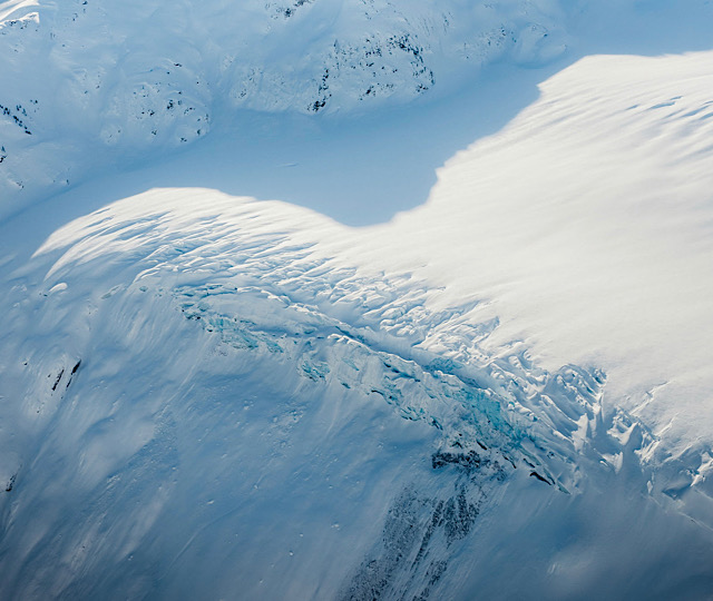
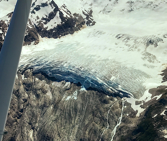
A Hanging glacier is a “body of ice that breaks off abruptly at the edge of a precipice or steep slope”. Hanging glaciers are typically formed as a glacier recedes up a steep cliff face. As the ice breaks off and falls in the valley below the glacier is left precariously perched on the rock. Amicus Glacier can be seen on our Prehistoric Glaciers & Peaks tour and is a perfect example of a vast hanging glacier.
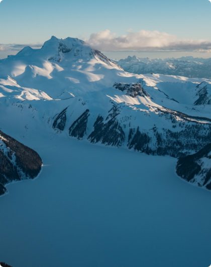
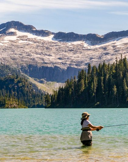
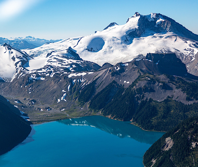
Glacial Flour “consists of fine-grained particles of rock created by the grinding of bedrock due to glacial erosion”. Glacial Flour is also commonly known as rock flour. This sediment deposit is carried by rivers and into the region’s glacial lakes. This sediment is the reason that Garibaldi Lake and Lake Lovely Water both appear to be a vibrant turquoise colour in the summer and fall. Light from the sun refracts on the particles in the water sending blue and green wavelengths into our eyes. Both of these natural gems can be seen on either our Whistler Backcountry Air Safari or our Squamish Explorer tours.
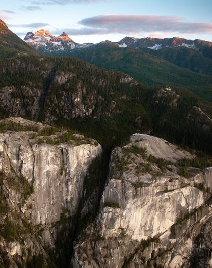
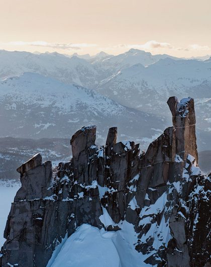
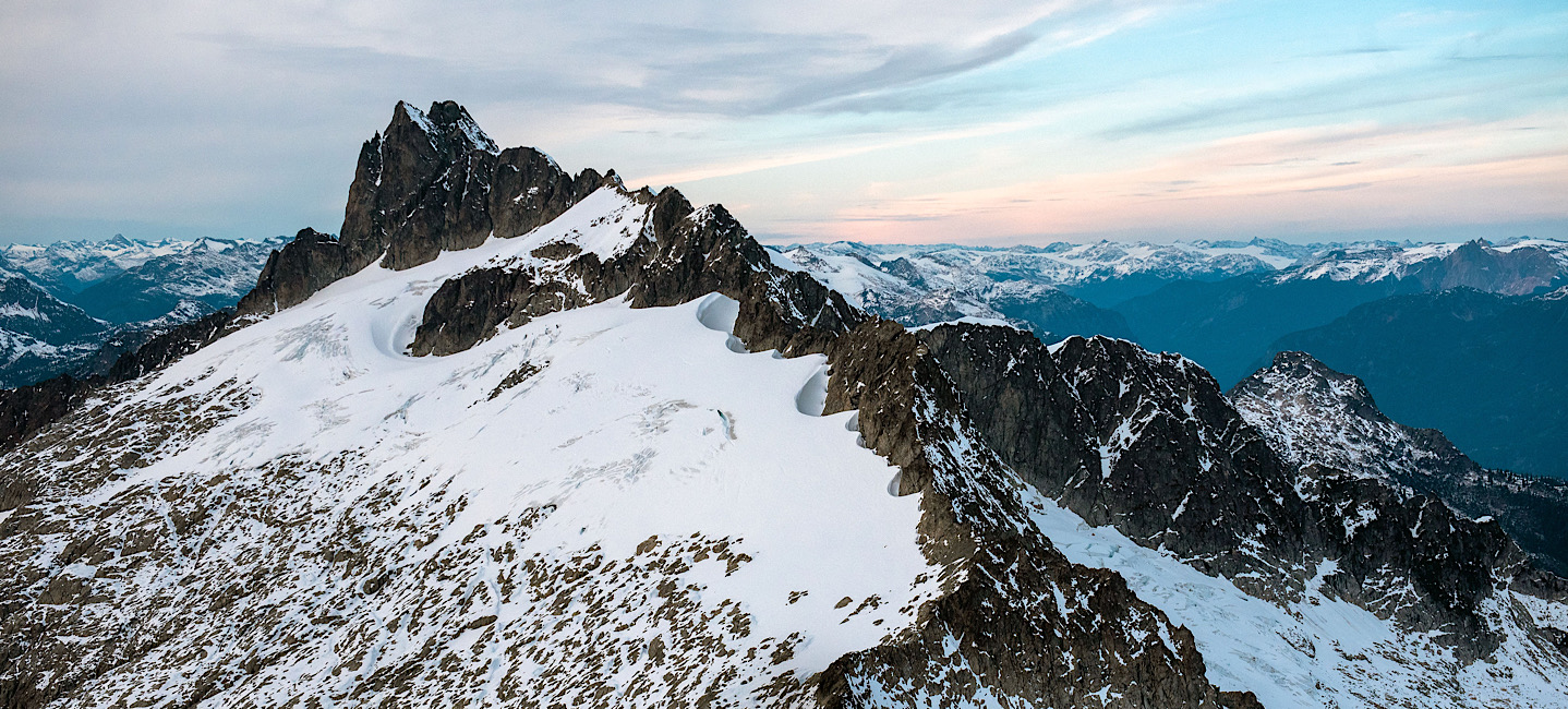
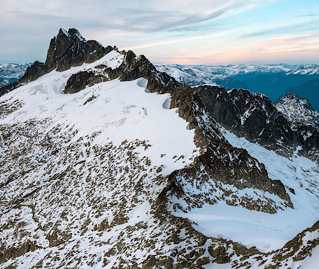
A nunatak is a name given to the part of a ridge, mountain, or peak that rises up out of the glacial ice it is surrounded by. It almost looks like someone poured resin into the valley or a basin and stopped before covering the very tops of the mountains. Intense glaciation during the last ice age saw the tops of most mountains ground down and rounded as the glaciers marched onward. But some peaks like Ossa, Alpha and Omega were left jagged and pointy. A result of being tall enough to poke out of the ice as it moved. Nunataks can be found all around Squamish. The Tantalus Range, is a perfect place to go nunatak spotting. This particular range can be seen right from the Sea To Sky Air office at Squamish Airport but is best seen on the Squamish Explorer scenic flight.
Now that you’re an expert geologist put your new-found knowledge to the test and see these features up-close on one of our guided scenic flights!